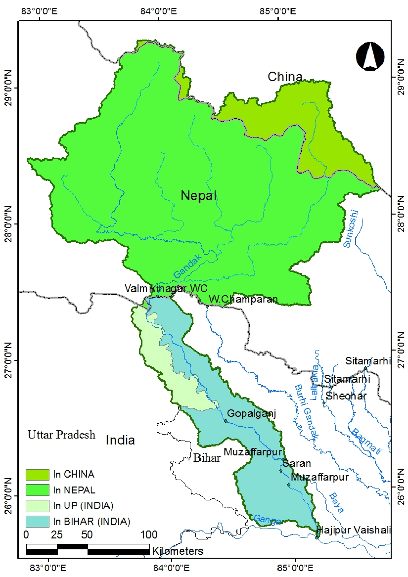
Gandak River
Why in News?
Recently, under Namami Gange Program, the development of river front on Gandak River in the district of Gopalganj, Bihar has been undertaken and two Ghats have been constructed.
- River Gandak was declared as National Waterway (NW)-37 from Bhaisalotan Barrage to Gandak and Ganga River confluence at Hajipur, Bihar along with 111 NWs in the country vide National Waterways Act, 2016.
What are the Key Facts about River Gandak ?
- About:
- The river Gandak, is also known as the Gandaki and Narayani River in Nepal. It is a significant river that flows through the northern part of India and Nepal.
- Valmiki National Park and Tiger Reserve in Bihar is located on the banks of this river.
- Source:
- The river Gandak originates at an altitude of 7620 m above main sea level in the north of Dhaulagisi in Tibet near Nepal border. Originating from the Himalayas, the river stretches over a length of 630 kilometers, with 445 kilometers running through India and 185 kilometers in Nepal.
- Drainage Basin:
- The Gandak River has a total drainage basin area of 29,705 square kilometers.
- The river flows through the Indian states of Bihar and Uttar Pradesh, and joins the Ganges near Patna just downstream of Hajipur.
- Tributaries:
- The major tributaries of the Gandak River include the Mayangadi, Bari, Trisuli, Panchand, Sarhad, Budhi Gandak.
What is National Waterways Act-2016?
- The National Waterways Act, 2016 is an act of the Indian parliament that was passed in March 2016. The act provides for the declaration of 111 waterways as National Waterways in India, including inland rivers, and canals.
- The act aims to promote the development of inland water transport and provide an alternative mode of transportation for goods and passengers.
