China Builds Bridge across Pangong Lake
For Prelims: India-China Standoff, Pangong Tso Lake, Line of Actual Control, Kailash Range.
For Mains: China’s Building Bridge across Pangong Lake, its implication for India, Background of India-China Standoff.
Why in News
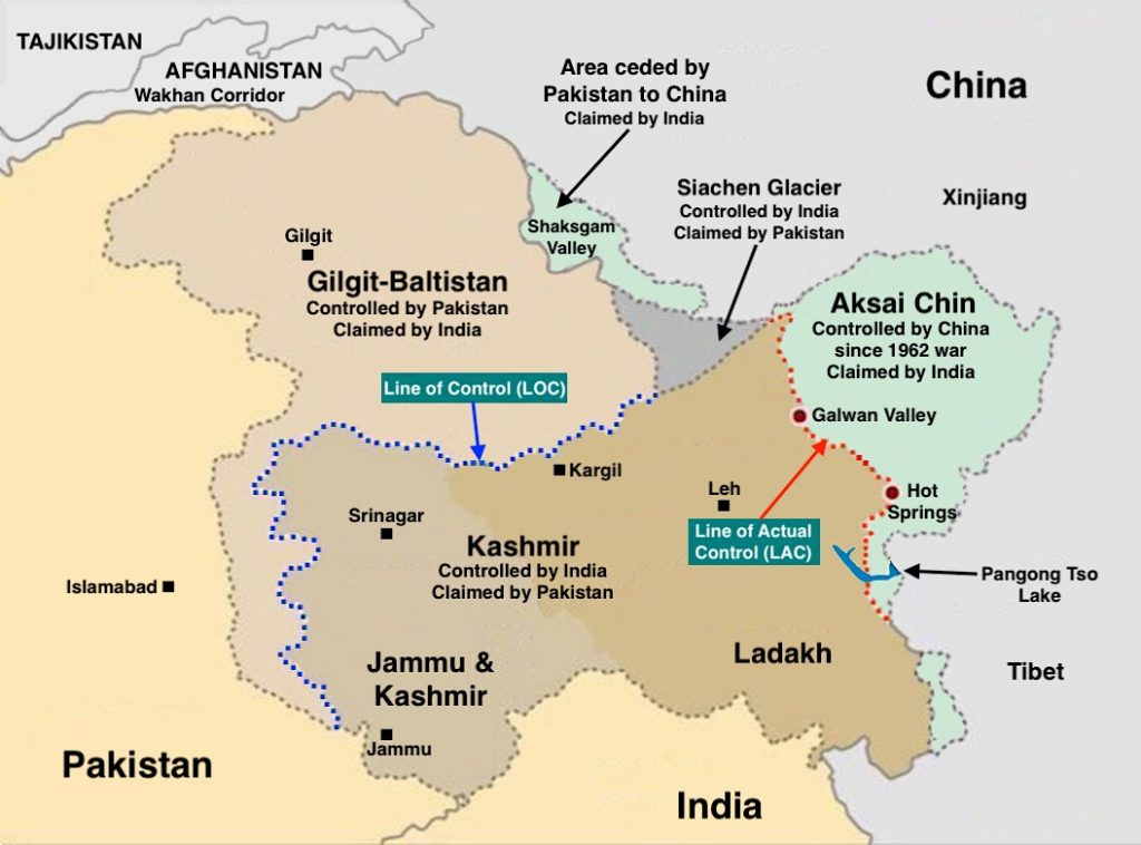
Recently, it was found that China is building a new bridge on Pangong Tso which will provide an additional axis to deploy troops faster between the north and south banks of the lake, and closer to the LAC (Line of Actual Control).
- Earlier, China’s new law on land borders came into effect from 1st January, 2022, at a time when border standoff in eastern Ladakh remains unresolved and several places in Arunachal Pradesh have been renamed recently by China as part of its claim on the Indian state.
- India too has been improving its infrastructure in the border areas. In 2021, the Border Roads Organisation completed more than 100 projects in border areas, the majority of which were close to the border with China.
Key Points
- Background:
- Since the military standoff began in May 2020, India and China have not only worked to improve existing infrastructure, but have also built several new roads, bridges, landing strips along the entire frontier.
- Towards the end of August 2020, India outmanoeuvred China to capture the previously unoccupied heights of the Kailash Range on the south bank of Pangong Tso lake.
- Indian troops positioned themselves on the peaks there, including Magar Hill, Gurung Hill, Rezang La, Rechin La, and this allowed them to dominate the strategic Spanggur Gap — it can be used for launching an offensive, as China had done in 1962 — and also gave them a view of the PLA garrison at Moldo.
- Indian troops had also positioned themselves above the Chinese troops in the Fingers area on the north bank. During this scramble for the heights, shots had been fired by both sides, a first in over four decades.
- Troops from the two countries remained on these heights through the harsh winter months. The significance of these positions was one of the main factors that compelled China to negotiate a pullback.
- Both countries agreed to a pullback from the north bank of the lake, and positions on the Kailash Range in the Chushul sub-sector south of Pangong Tso.
- About:
- The bridge is being constructed more than 20 km east of Finger 8 on the lake’s north bank – India says Finger 8 denotes the LAC.
- The Lake is overlooked by the Finger Area - a set of eight cliffs extending out of the Sirijap range (on the northern bank of Lake).
- Pangong Tso, an endorheic lake, is 135 km long, of which more than two-thirds is under Chinese control.

- The north and south banks of the lake were among the several friction points that surfaced after the start of the standoff. Before India and China pulled back troops from the north and south banks in February 2021, the area had seen massive mobilisation and the two sides even deployed tanks, barely a few hundred metres apart in some locations.
- The bridge site is just east of Khurnak Fort in Rutog county where the PLA (People’s Liberation Army) has frontier bases.
- Historically a part of India, Khurnak Fort has been under Chinese control since 1958.
- From Khurnak Fort, the LAC is considerably west, with India claiming it at Finger 8 and China claiming it at Finger 4.
- The bridge is being constructed more than 20 km east of Finger 8 on the lake’s north bank – India says Finger 8 denotes the LAC.
- Significance for China:
- The bridge will cut a 180-kilometer loop from Khurnak to the south banks through Rudok reducing the distance between Khurnak and Rudok to 40-50 kilometres, rather than approximately 200 kilometres as previously stated.
- The building of the bridge will allow it to mobilise its troops faster in this area, hoping to prevent a repeat of what happened in August 2020.
- Implication for India:
- The bridge is in their territory, and the Indian Army will have to factor this in its operational plans.
- The widening of roads, building of new roads and bridges, new bases, airstrips, advance landing bases, etc are not restricted to the eastern Ladakh region, but are happening across the three sectors of the India-China boundary (Eastern, Middle and Western).