Chhattisgarh GK
Last Updated: May 2024
Chhattisgarh GK
| Formation | 1 November, 2000 |
| Capital | New Raipur |
| Population | 2,55,40,196 |
| Area | 1,35,192 Sq. kms. |
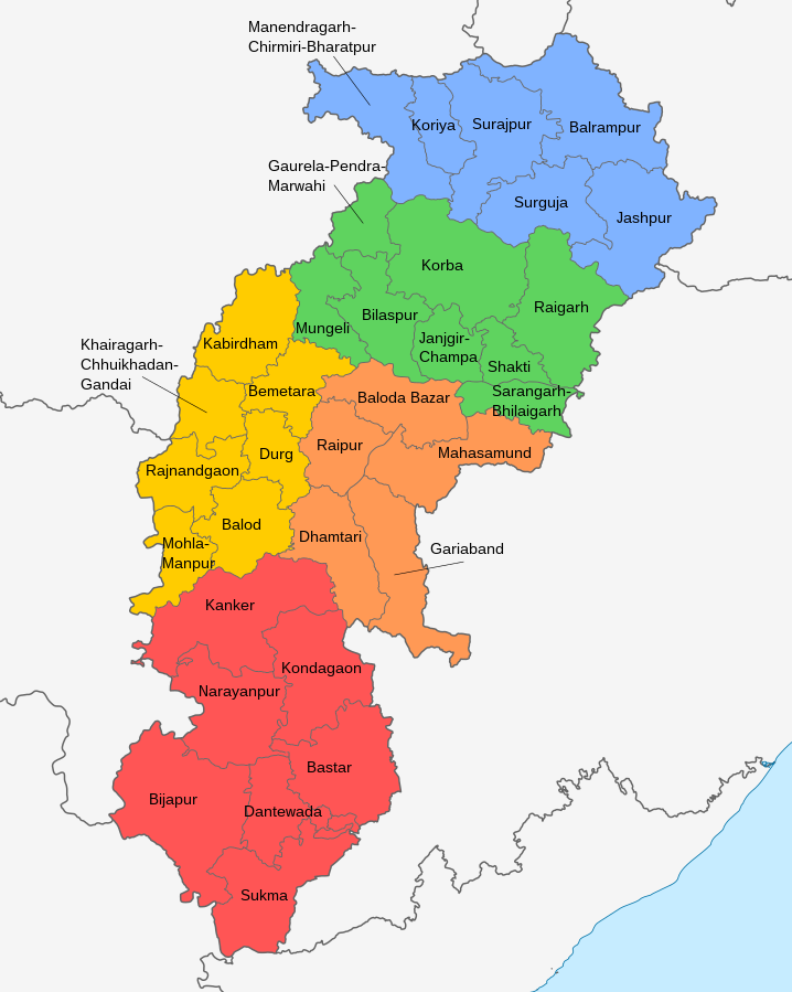
| Total Districts | 33 |
| Ancient Name of the State | Dakshin Kosal |
| Shape of State | Sea Horse (hippocampus) |
| High Court | Bilaspur (19th of Country) |
| State Symbol | |||
| Sentence: Credible Chhattisgarh |
 |
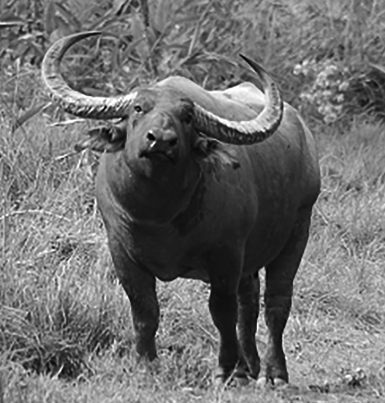
State Animal: Forest Buffalo |
 |
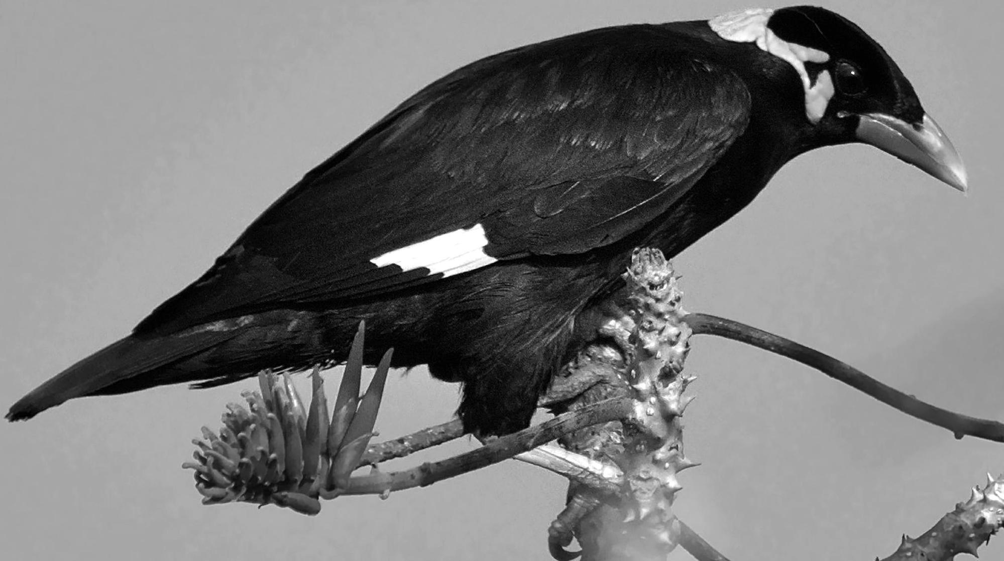
| State Bird: Hill Myna |
 |
State Tree: Sal |
 |
Chhattisgarh : General Information
- State Name – Chhattisgarh
- Ancient name of the state - Dakshin Kosal
- Establishment of the state - 1 November, 2000 (26th state of the country)
- Mother State of the State - Madhya Pradesh
- Chhattisgarh became a division of Madhya Pradesh in -1862
- State Capital - Nava Raipur (earlier Raipur)
- Act for State formation - Madhya Pradesh State Reorganization Act, 2000
- Time of State Formation - 9th Five Year Plan (1997-2002)
- Official language of the state - Chhattisgarhi (accepted on November 28, 2007)
- State legislature - Unicameral (assembly)
- Rajya Sabha seat in the state - 5
- Lok Sabha seats in the state - 11
- Assembly seats in the state - 90
- State High Court – Bilaspur (19th High Court of the country)
- Railway Zone in the State - South-East Central Railway (Bilaspur) (16th Railway Zone of the country)
- Government Press in the State - Rajnandgaon (1989)
- Braille Script Press in the State - Tifra (Bilaspur)
- State Revenue Division Headquarters - Bilaspur
- State Ethnic Museum - Jagdalpur
- Total number of districts in the state - 33
- Number of districts at the time of state formation - 16
- Largest district by area - Rajnandgaon
- Smallest district by area - Durg
Geographical Location
- Latitude – 17°46' N to 24°5'N.
- Longitude – 80°15' E to 84°24'E.
- The area of the state is 1,35,192 sq. km. (4.14% of the total area of the country and 30.47% of the total area of Madhya Pradesh)
- Districts of the state through which Tropic of Cancer passes - 03 (Korea, Surajpur, Balrampur)
- Districts of the state through which the Indian Standard Time Line (IST) passes -07 (Surajpur, Korba Janjgir-Champa, Balodabazar, Mahasamund, Gariaband, Balod)
- Meeting point of Tropic of Cancer and IST of the state - Surajpur (Korba in other sources)
- Rank in the country by area - 10th
- The width of the state from east to west is - 435 km.
- The length of the state from north to south is - 700 to 800 km.
- Number of states adjoining the state - 7
- Number of districts adjoining other states - 21
- The state touching the longest border of Chhattisgarh - Odisha
- State touching the smallest border of Chhattisgarh - Andhra Pradesh
- The largest geomorphic region of Chhattisgarh - the plain of Chhattisgarh
- The smallest and highest geomorphic region of Chhattisgarh - Jashpur-Samaripat
- Largest drainage system of Chhattisgarh - Mahanadi drainage system
- Smallest drainage system of Chhattisgarh - Narmada drainage system
- The largest soil group of Chhattisgarh - red-yellow soil
- The smallest soil group of Chhattisgarh - laterite soil
- Climate of Chhattisgarh - Tropical Monsoon
- Cherrapunji of Chhattisgarh - Abujhmad
- The coldest place in Chhattisgarh - Mainpat (Surguja)
- Hottest place of Chhattisgarh - Champa
- Highest peak of Chhattisgarh - Gaurlata (1225 m.)
- The longest river of Chhattisgarh - Mahanadi (858 km)
- Shimla of Chhattisgarh - Mainpat
| Geographical Boundary of State | |||
| S. No. | Direction | State | Number and name of the touching districts |
| 1. | East | Odisha | 08 (Jashpur, Raigarh, Mahasamund, Gariaband, Dhamtari, Kondagaon, Bastar, Sukma) |
| 2. | North-west | Madhya Pradesh | 07 (Balrampur, Surajpur, Koriya, Gaurela-Pendra-Marwahi, Mungeli, Kawardha, Rajnandgaon) |
| 3. | West | Maharashtra | 04 (Rajnandgaon, Kanker, Narayanpur, Bijapur) |
| 4. | South-west | Telangana | 02 (Bijapur, Sukma) |
| 5. | North-east | Jharkhand | 02 (Balrampur, Jashpur) |
| 6. | North | Uttar Pradesh | 01 (Balrampur) |
| 7. | South | Andhra Pradesh | 01 (Sukma) |
| Major Mountains and Peaks of Chhattisgarh | |||
| S.No. | Hills/Peaks | Latitude (in metres) | Region |
| 1. | Gaurlata | 1225 | Samaripat (Balrampur) |
| 2. | Nandiraj | 1210 | Bailadila (Dantewada) |
| 3. | Badargadh | 1176 | Macal Range (Kawardha) |
| 4. | Mainpat | 1152 | Surguja |
| 5. | Palmagarh Peak | 1080 | Plateau of Pendra-Lormi (Korba) |
| 6. | Abujhmad Hills | 1076 | Narayana pur |
| 7. | Lafagarh Peak | 1048 | Plateau of Pendra-Lormi (Korba) |
| 8. | Dhari Dongar (Shishupal) | 899 | Mahasamund |
The Main Promoters of Chhattisgarh and Their Title
- Father of Co-operatives in Chhattisgarh - Thakur Pyarelal
- Father of cooperatives in Durg district - Pt. Ratnakar Jha
- Father of cooperatives in Raipur district - Wamanrao Lakhe
- Father of Journalism in Chhattisgarh - Madhavrao Sapre
- Founder of Satnam Panth in Chhattisgarh - Guru Ghasidas
- Founder of Kabir Panth in Chhattisgarh - Chudamani Sahib
- Mangal Pandey of Chhattisgarh - Hanuman Singh
- Bhagat Singh of Chhattisgarh - Parasram Soni
- Tatya Tope of Chhattisgarh - Gundadhur
- Gandhi of Chhattisgarh - Pt. Sunderlal Sharma
- Gandhi of Bastar - Manku Ram Sodhi
- Valmiki of Chhattisgarh - Gopal Mishra
- Panini of Chhattisgarh - Hiralal Kavyopadhyay
- First Martyr of Chhattisgarh - Virnarayan Singh
- The last martyr of the 1857 revolution - Surendra Sai
- Legislator of Madhya Prant - Ghanshyam Singh Gupta (1937)
- Madhya Pradesh Legislator - Mathura Prasad Dubey (1981)
- The first preacher of Christianity - Father T. Lor (1868)
- Father of Dance - Dau Dular Singh Mandraji
- Father of Pandavani - Jhaduram Devangan
- The savior of folk art - Dau Ramchandra Deshmukh
- Priest of folk art - Mahasingh Chandrakar
Popular Places of Chhattisgarh
- Kashi/Varanasi of Chhattisgarh - Kharaud
- Kashmir of Chhattisgarh - Chaiturgarh (Korba)
- Chittor of Chhattisgarh - Lafagarh (Korba)
- Khajuraho of Chhattisgarh - Bhoramdev (Kabirdham)
- Prayag of Chhattisgarh - Rajim (Gariaband)
- Shimla of Chhattisgarh - Mainpat (Surguja)
- Nagaloka of Chhattisgarh - Tapkara (Jashpur)
- Cherrapunji of Chhattisgarh - Abujhmad (Narayanpur)
- The oldest temple of Chhattisgarh - Devrani-Jethani Temple (5th-6th century) (Talagaon, Bilaspur)
- Knowledge Capital of Chhattisgarh – Bhilai (Durg)
- City of ponds of Chhattisgarh - Ratanpur (Bilaspur)
- The city of temples in Chhattisgarh - Arang (Raipur)
- City of tanks in Chhattisgarh - Ratanpur (Bilaspur)
- City of intersections in Chhattisgarh - Jagdalpur (Dantewada)
- Island of Sal forests in Chhattisgarh - Bastar
- Tomato Capital of Chhattisgarh - Ludeng (Jashpur)
- Sivakasi of Chhattisgarh - Bilaspur
First in Chhattisgarh
- Chhattisgarh's first Regional Dynasty - Rajarshitulya Kul Dynasty
- First Kalchuri Ruler - Kalingaraj (Capital-Tamangan)
- First Maratha Ruler - Bimbaji Bhosale (Capital-Ratanpur)
- First Subedar - Mahipat Rao Dinkar (Capital - Ratanpur)
- First woman ruler - Prapulla Kumari Devi
- First Tribal Rebellion - Halba Rebellion (1774-1776)
- First Chief Minister - Shri Ajit Pramod Kumar Jogi
- First Chief Justice - Shri W.A. Shishak
- First Acting Chief Justice - Shri R.S. Garg
- First Election Commissioner - Dr. Sushil Trivedi
- First State Human Rights Commission Chairman - Shri K. M. Agarwal
- First Speaker of the Vidhan Sabha - Shri Rajendra Prasad
- First Deputy Speaker of Vidhan Sabha - Shri Banwarilal Agrawal
- First Home Minister - Shri Nandkumar Patel
- First Governor - Shri Dinesh Nandan Sahai
- First Chief Information Commissioner - Shri A.K. Vijayvargiya
- First Chief Secretary - Shri Arun Kumar
- First State Women Commission Chairman - Smt. Hemwant Porte
- First Director General of Police - Shri Mohan Shukla
- First Chairman of Chhattisgarh State Public Service Commission - Shri Mohan Shukla
- First Woman Minister (in undivided Madhya Pradesh) - Smt. Padmavati Devi
- First Woman Minister (in Chhattisgarh State) - Smt. Geeta Devi Singh
- First woman MP - Minimata (from Raipur parliamentary constituency)
- Most times MP from Chhattisgarh - Late. Vidyacharan Shukla (9 times)
- First Chairman of Chhattisgarh State Co-Service Commission - Pawan Diwan
- The first chairman of the Chhattisgarh State Electricity Regulatory Commission - S. K Mishra
- The first person of Chhattisgarh, who became the Chief Minister of any state - Pt. Ravi Shankar Shukla (Chief Minister of Madhya Pradesh)
- The first person of Chhattisgarh, who became the governor of a state - E. Raghavendra Rao (Governor of Madhya Pradesh)
- The first person from Chhattisgarh, who became the Speaker of Madhya Pradesh Legislative Assembly - Mathura Prasad Dubey
- First person to be awarded Padma Shri - Mukutdhar Pandey (1976)
- First woman to be awarded Padma Shri - Teejan Bai (1987)
- First person to be awarded Padma Bhushan - Habib Tanveer (2002)
- First woman to be awarded Padma Bhushan - Teejan Bai (2003)
- First recipient of Minimata Samman - Smt. Binny Bai (2001)
- First recipient of Dr. Khubchand Baghel Award - Shrikant Govardhan (2001)
- First recipient of Pt. Ravi Shankar Shukla Award - Carebhushan (2001)
- First recipient of Pt. Sunderlal Sharma Award - Vinod Kumar Shukla (2001)
- First recipient of Gundadhur Samman - Ashish Arora (2001)
- First College - Chhattisgarh College, Raipur (1938)
- First Sanskrit College - Raipur (1955)
- First University - Indira University of Arts and Music, Khairagarh (Rajnandgaon) (1956)
- First General Education University - Pt. RaviShankar Shukla University, Raipur (1964)
- First Private University - Maharishi University, Bilaspur (2002)
- First Medical College - Pt. Nehru Medical College, Raipur (1963)
- Chhattisgarh's oldest I.T.I. - Koni (Bilaspur 1904)
- State's first law university - Hidayatullah National Law University, Raipur
- State's first private medical college - Chandulal Chandrakar Memorial Medical College, Durg
- State's first sports university - Rajnandgaon (proposed)
- State's first government medical college - Pt. Jawaharlal Nehru Memorial Medical College, Raipur (1963)
Transportation and Communication
- Total length of state roads - 32932 km (In the case of March 2019)
- The total length of state roads is - 32932 km. (as of March 2019)
- Length of National Highway - 3526 km.
- Length of state highway - 4176 km.
- Length of main district road - 11501 km.
- Length of rural road and other district roads - 13729 km.
- The longest National Highway in the state - NH30 (638.80 km)
- The shortest National Highway in the state - NH163 (A) (12 km)
- PWD Paved Roads - 30508.13 Km.
- PWD unpaved Roads - 2323.40 Km.
- Largest State Highway - SH5
- Shortest State Highway - SH14
- The length of the roads under Pradhan Mantri Gram Sadak Yojana is - 31758.73 km. (as of March 31, 2019)
- Total number of roads under Pradhan Mantri Gram Sadak Yojana - 8193 Km
- First rail operation in Chhattisgarh - November 27, 1888 (Bengal-Nagpur)
- Establishment of Bilaspur Railway Division - 1900 (under Calcutta Railway)
- Declaration of South-East-Central Railway (SCR) zone - 20 September, 1998 (by the then Prime Minister Atal Bihari Vajpayee)
- Inauguration of South-East-Central Railway - 7th April, 2003
- The total length of the railway line in the state is - 1196 km.
- Headquarter of South-East-Central Railway - Bilaspur
- Chhattisgarh's only international airport - Swami Vivekananda Airport (Mana, Raipur)
- The only river for water transport in Chhattisgarh - Sabari river
- First newspaper - Chhattisgarh Mitra (1900)
- First Chhattisgarhi Film - Kahi Debe Sandesh
Literacy and Education
Literate (Census-2011)
- Total Literate Population - 15380000 (1.5 Crore)
- Male Literate Population - 8808000 (33 Lakh)
- Female Literate Population - 6572000 (65 Lakh)
- Rural Literate Population - 11009000 (1.10 crore)
- Urban Literate Population - 4371000 (43 Lakh)
Higher Education Institution
- Number of government colleges in the state - 253
- Number of non-government colleges in the state - 257
- State's only Sanskrit college - Govt. D.C.V. Sanskrit College, Raipur
- Total medical colleges in the state - 10 (7 government, 03 private)
- State's only Central Medical College - All India Institute of Medical Sciences (AIIMS), Raipur
- Number of University in the State - 24
- No. of Central University in the State - 01
- Number of Government University in the State - 09
- Number of Private University in the State - 14
- State's first and only university - Indira Arts and Music University, Khairagarh (Rajnandgaon) (1956)
- State's first private university - Maharishi University, Bhilai (Durg)
- The only central university in the state - Guru Ghasidas Central University, Koni (Bilaspur)
- State's only and country's 11th open university - Pandit Sundarlal Sharma University, Birkona (Bilaspur)
- State's only journalism university - Kushabhau Thackeray University of Journalism and Mass Communication, Kathadid (Raipur)
- State's only technical university - Chhattisgarh Swami Vivekanand Technical University, Bhilai (Durg)
- State's only agricultural university - Indira Gandhi Agricultural University, Raipur
- State's only law university - Hidayatullah National Law University, Raipur
- State's only veterinary university - Kamdhenu University, Anjora (Durg)
- State's only medical university - Pt. Deendayal Upadhyay Ayush and Health University, Raipur
Population (As per Census 2011)
- Total population of the state - 2,55,45,198
- State's Population of Country's Total Population - 2.11%
- Most Populated District - Raipur (4063872)
- District with highest female population - Narayanpur (139820)
- District with highest female population - Raipur (2015686)
- District with lowest female population - Narayanpur (69716)
- District with highest male population - Raipur
- District with lowest male population - Narayanpur
- Rural Population - 19607961
- District with highest rural population - Raipur (2580583)
- District with least rural population - Narayanpur (117714)
- Urban Population - 5937237
- District with highest urban population - Raipur (1483289)
- District with least urban population - Narayanpur (22106)
- Sex Ratio - 991:1000
- District with highest sex ratio - Kondagaon (1033:1000)
- District with lowest sex ratio - Raipur (963:1000)
- Population Growth Rate - 22.61%
- District with highest population growth rate - Kabirdham (41.71%)
- District with lowest population growth rate - Bijapur (8.78%)
- Birth rate - 24.90%
- Rural birth rate - 26.30%
- Urban birth rate - 18.30%
- Mortality - 7.90%
- Rural Mortality - 8.30%
- Urban mortality - 6.10%
- Population Density - 189 persons per sq.km.
- District with highest population density - Janjgir-Champa (420 persons per sq. km.)
- District with lowest population density - Bijapur and Narayanpur
- Total literate population of the state - 15379922
- District with highest literate population - Raipur
- District with least literate population - Narayanpur
- District with highest literacy % - Durg (79.06%)
- District with lowest literacy % - Bijapur (40.86%)
- District with highest female literacy - Raipur
- District with lowest female literacy - Narayanpur
- District with highest female literacy % - Durg (70.23%)
- District with lowest female literacy % - Bijapur (31.11%)
- District with highest male literacy - Raipur
- Lowest male literacy district - Narayanpur
- District with highest male literacy % - Durg (87.82%)
- District with lowest male literacy % - Bijapur (50.46%)
Forests, Wildlife & Sanctuaries
Forest
- The forest area in the state is - 59772 sq. km. (As per Chhattisgarh Forest Ministry), 55547 sq. km. (As per ISFR-2017)
- Forests in the total geographical area of the state - 44.21%
- Rank of the state in terms of forest cover in the country - third (1st - Madhya Pradesh, second - Arunachal Pradesh)
- Reserved forest in the state - 25782.17 sq.km. (43.13%)
- The protected forest in the state is - 24036.1 sq.km. (40.22%)
- Unclassified forest in the state - 9954.13 sq.km. (16.65%)
- Sal forest in the state - 24244.88 sq. km. (40.56%)
- Saugan forest in the state - 5533.13 sq. km. (9.42%)
- The mixed forest in the state is - 26018.38 sq. km. (43.52%)
- Work in the State Commissionable Forest- 3876.01 Sq.km. (6.5%)
- The district with the maximum forests by area - Narayanpur
- The district with the least forest by area - Durg
- Most forested district on the basis of % - Bastar/Narayanpur
- The district with the least number of forests on the basis of % - Durg
- District with maximum reserve forest area - Dantewada
- District with least reserve forest area - Korba
- District with maximum protected forest area - Surguja
- The district with the least forest area - Janjgir, Champa
- Establishment of Chhattisgarh State Forest Development Corporation - May 2001 (Raipur)
- Forester Training Institute in the State - Jagdalpur
- Forest Guard Training Institute in the State - 03 (Mahasamund, Sakti, Jagdalpur)
- Forest Schools in the State - 03 (Ambikapur, Kawardha, Bhanupratappur)
Wildlife and Sanctuary
- Number of National Parks in the State - 03
- State's first national park - Indravati National Park
- The largest national park in the state - Guru Ghasidas National Park (1441 sq. km.)
- The state's smallest national park - Kanger Ghati National Park (200 sq. km.)
- State's only Project Tiger declared National Park - Indravati National Park
- Wildlife Sanctuaries - 11
- State's largest wildlife sanctuary – Tamorpingala (608 sq.km.)
- The state's smallest wildlife sanctuary - Badalkhol (105 sq. km.)
- State's oldest wildlife sanctuary - Sitanadi (1974)
- State's Newest Wildlife Sanctuary - Bhoramdev (2001)
- Most tiger reserve in the state - Achanakmar (Mungeli)
- Most leopard sanctuary in the state - Sitanadi (Dhamtari)
- Number of Tiger Reserves in the State - 04 (Indravati Tiger Reserve, Sitanadi-Udanti Tiger Reserve, Achanakmar Tiger Reserve)
- State's Fourth Tiger Reserve - Guru Ghasidas-Tamor Pingla (Proposed)
- State's only Biosphere Reserve - Achanakmar-Amarkantak Biosphere Reserve (2005)
Minerals
- Estimated number of minerals in the state - 28
- Establishment of State Mineral Development Corporation - 7 June 2001
- The position of the state in terms of mineral production - Fifth
- Location of the state from the point of view of mineral storage - third (first - Odisha, second - Jharkhand)
- Contribution of minerals in the revenue income of the state - 27%
- State's contribution to the main mineral revenue generation of the country - 9.3%
- Mineral with highest royalty rate in the state - Iron Ore
- Iron ore production unit in the state - NMDC.
- Coal producing unit in the state - SECL.
- Major coalfields in the state - Hasdeo Rampura field, Mand valley coalfield
- India's largest mechanized mine - Bailadila
- For the production of aluminum in the state - BALCO (the first public sector company established BALCO
Industry
- Establishment of Chhattisgarh State Industrial Development Corporation Limited (CSIDC) - 7 April, 2001
- State's first industrial center – Urla (Raipur) 1990
- The largest industrial center of the state - Siltara (Raipur)
- Highest employing industrial area in the state - Urla (Raipur)
- State's most invested industrial center - Urla (Raipur)
- Industrially most developed district - Durg
- State's first special economic zone - Raipur
- State's latest special economic zone - Rajnandgaon
- State's First Central Thermal Plant - NTPC
- State's only catechu plant - Sarguja Wood Products
- The state's largest steel plant – Bhilai Steel Plant (BSP)
- State's largest aluminum company – BALCO (Korba)
- State's first industry - Cotton Industry (Bengal Nagpur Cotton Mill)
- State's only Jute Industry Mill - Mohan Jute Mill
- State's first cement plant - Associate Cement Company
- Most of the cement factories/cement hub in the state - Balodabazar
- State's first sugar factory - Bhoramdeo Sugar Factory Ramhepur (Kawardha) (March 2003)
Industrial Park
- Aluminum Park - Dondro (Korba)
- Apparel Park - Bhanpuri (Raipur)
- Agro Park - Bastar
- Biotech Park - Ambikapur (Surguja)
- Deer Park - Kotmasar Nagaltar (Bastar)
- Food Park - Borai (Durg), Tedesara (Rajnandgaon)
- Naveen Food Park (200) in - 146 Blocks
- Herbal Park - Bagoud (Dhamtari)
- Electronic Manufacturing Park - Naya Raipur
- Engineering Park - Hathkhoj, Bhilai (Durg)
- IT Park - Naya Raipur
- Gems & Jewellery Park - Naya Raipur (Under Establishment)
- Kisan Shopping Mall - Rajnandgaon, Mahasamund
- Logistics Park - Raipur
- Biotechnology Park - Mungi (Raipur)
- Metal Park - Rawabhata (Raipur)
- Plastic Park - Tilda (Raipur), Khairjhiti (Rajnandgaon)
- Science Park - Tuta (Raipur), Sukma
- Snake Park - Tapkara (Jashpur)
- Software Technology Park - Bhilai (Durg)
- Traffic Park - Lagra (Bilaspur)
- Apparel Training & Design Center - Bilaspur, Raipur, Bhilai, Rajnandgaon, Sukma
Names of Various Buildings of Chhattisgarh Government
- Mahanadi Bhawan - Ministry and Secretariat Building
- Indravati Bhawan - Directorate Building
- Minimata Bhawan - Assembly building
- Karuna - Chief Minister's residence
- Sangwari - MLA's rest house
- Pahuna - State Government's rest house
- Sanjeevani - State Hospital
- Samvedana - Assembly Speaker's residence
- Sonakhan - State Mineral Building
- Mitanin - District Panchayat Bhawan
- The share of agricultural work in the total land of the state - 51%
- Average agricultural holding size in the state - 1.36 hectares
- Asia's largest tamarind market - Jagdalpur (Bastar)
- Rice Research Center - Labhandi (Raipur)
- Tomato Research Center - Mainpat (Surguja)
- District with maximum cultivable land - Rajnandgaon
- The district with the least cultivable land - Narayanpur
- State's oldest animal market - Ratanpur (Bilaspur)
- State's largest animal market - Bhaisathan (Raipur)
- State's position in fish production in the country - 5th
- State's first multi-purpose project - Hasdeo Bango / Minimata Project
- State's biggest irrigation project - Mahanadi Project
- The longest dam of the state - Gangrel / Ravi Shankar Dam
- Most irrigated district - Janjgir, Champa
- Minimum Irrigated District - Narayanpur
