Important Facts For Prelims
Surangam System
- 21 Aug 2021
- 3 min read
Why in News
The Karez System of Afghanistan is in threat whereas a similar system named Surangam in South India is thriving.
- Surangams resemble the karez System both in structure and spread.
Key Points
- About Surangams:
- The surangam or suranga is usually found in northern Kerala and southern Karnataka.
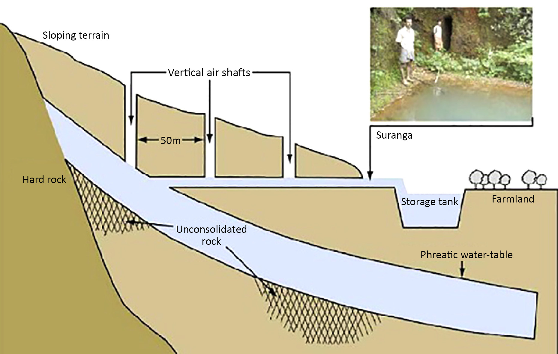
- Surangam is basically a tunnel dug through a laterite hillock from the periphery of which water and moisture seeps out.
- Surangams are similar to Qanats which once existed in Mesopotamia and Babylon around 700 Before Common Era (BCE). By 714 BCE, this technology had spread to Egypt, Persia and India.
- Qanats are underground tunnel systems that bring infiltrated groundwater, surface water, or spring water to the earth's surface using only gravitational force.
- This system has been very effectively used for domestic and agriculture purposes in dry areas of northern Malabar.
- Some people believe the surangam is indigenous and a likely origin of the suranga system refers to 18 Karhada Brahmin families that had been moved to the Kasargod area from modern-day Maharashtra in the 17th century under duress.
- Karez System:
- The karez system is a legacy of its Persian cultural moorings. It has suffered extensive damage in 43 years of war and stares at an uncertain future under the Taliban’s second regime.
- Karez is a water harnessing technology in which groundwater is brought to the surface by a tunnel.
- In this system, no mechanical pump or lift is used. Gravity alone brings the water from the underground source.
- The technology originated in Persia/Iran and was widely used during the medieval period.
| Sr. No | Ecological Region | Traditional Water Management System |
| 1. | Trans - Himalayan Region | Zing |
| 2. | Western Himalaya | Kul, Naula, Kuhl, Khatri |
| 3. | Eastern Himalaya | Apatani |
| 4. | North Eastern Hill Ranges | Zabo |
| 5. | Brahmaputra Valley | Dongs / Dungs/ Jampois |
| 6. | Indo-Gangetic Plains | Ahars – Pynes, Bengal’s Inundation Channels, Dighis, Baolis |
| 7. | The Thar Desert | Kunds, Kuis/beris, Baoris / Ber/ Jhalaras, Nadi, Tobas, Tankas, Khandins, Vav/Bavadi, Virdas, Paar |
| 8. | Central Highlands | Talab, Bandhis, Saza Kuva, Johads, Naada/Bandh, Pat, Rapat, Chandela Tank, Bundela Tank |
| 9. | Eastern Highlands | Katas / Mundas / Bandhas |
| 10. | Deccan Plateau | Cheruvu, Kohli Tanks, Bhandaras, Phad, Kere, The Ramtek Model |
| 11. | Western Ghats | Surangam |
| 12. | West Coastal Plains | Virdas |
| 13. | Eastern Ghats | Korambu |
| 14. | Eastern Coastal Plains | Eri / Ooranis |
| 15. | The Islands | Jack Wells |


