Important Facts For Prelims
Nepal’s Currency Featured Kalapani Region
- 07 May 2024
- 5 min read
Why in News?
Recently, Nepal announced the printing of a new Rs 100 currency note with a map that shows the contentious territories of Lipulekh, Limpiyadhura and Kalapani, already termed as “artificial enlargement” and “untenable” by India.
- India responded sharply to Nepal's decision, with India’s External Affairs Minister stating that it will not change the situation or the reality on the ground.
What are the Regions of Border Dispute Between India and Nepal?
- About:
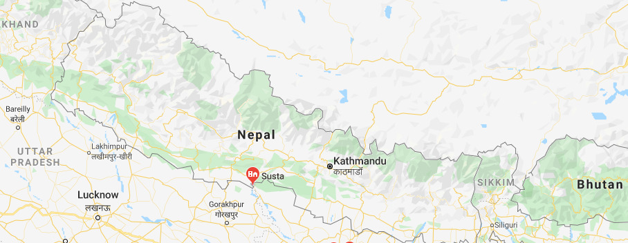
- Currently, India and Nepal have border disputes over the Kalapani-Limpiyadhura-Lipulekh trijunction and Susta area (West Champaran district, Bihar).
- Kalapani-Limpiyadhura-Lipulekh Trijunction (Kalapani Region):
- This is a 35-square-kilometre area located in the northwestern part of Nepal, near the tri-junction where India, Nepal, and China meet.
- Kalapani is a valley that is administered by India as a part of the Pithoragarh district of Uttarakhand. It is situated on the Kailash Mansarovar route.
- Kalapani is advantageously located at a height of over 20,000 ft and serves as an observation post for that area.
- The Kali River in the Kalapani region demarcates the border between India and Nepal.
- The Treaty of Sugauli was signed by the Kingdom of Nepal and British India (after the Anglo-Nepalese War) in 1816.
- The treaty designated the Kali River (or the Mahakali River) as the western boundary of Nepal.
- Land east of the Kali River came under Nepal's control, while territory west of the river became part of British India (present-day India).
- The discrepancy in locating the source of the Kali River led to boundary disputes between India and Nepal, with each country producing maps supporting their claims.
- Claims of Different Parties over Kalapani Region:
- Nepal’s Stand:
- According to Nepal’s claims, the Kali River originates from a stream at Limpiyadhura, northwest of Lipu Lekh.
- Thus Kalapani, Limpiyadhura, and Lipu Lekh, fall to the east of the river and are part of Nepal’s Dharchula district.
- The territory of Kalapani was offered to India by King Mahendra after the 1962 India-China war who wanted to help India’s security concerns due to perceived lingering Chinese threats.
- India’s Stand:
- India claims that the Kali River originates in springs well below the Lipu-lekh Pass (or Lipulekh Pass itself), effectively bringing the Kalapani region under Indian control.
- The Sugauli Treaty does not demarcate the area north of these streams.
- The administrative and revenue records of the nineteenth century also show that Kalapani was on the Indian side, and counted as part of Pithoragarh district of Uttarakhand.
- India claims that the Kali River originates in springs well below the Lipu-lekh Pass (or Lipulekh Pass itself), effectively bringing the Kalapani region under Indian control.
- Nepal’s Stand:
- Susta Region:
- The Treaty of Sugauli defined the Gandak River as the international boundary between India and Nepal.
- The right bank of the river was under Nepal's control while the left bank was under India's control.
- Susta village was initially on the right bank when the treaty was signed and it was a part of Nepal.
- However, over the years, the Gandak River changed its course and Susta moved to the left bank and is now currently under India's control.
Conclusion
- While both countries present historical documents and interpretations of the Sugauli Treaty to support their claims, a resolution remains elusive.
- Moving forward, constructive dialogue and a willingness to find common ground will be crucial to resolving this long-standing issue and fostering a stronger relationship between Nepal and India.
UPSC Civil Services Examination Previous Year Question (PYQ)
Q. Consider the following pairs: (2016)
Community sometimes In the affairs of mentioned in the news
- Kurd — Bangladesh
- Madhesi — Nepal
- Rohingya — Myanmar
Which of the pairs given above is/are correctly matched?
(a) 1 and 2
(b) 2 only
(c) 2 and 3
(d) 3 only
Ans: C


