Massive Shelf Clouds Formation | 14 Jul 2023
Why in News?
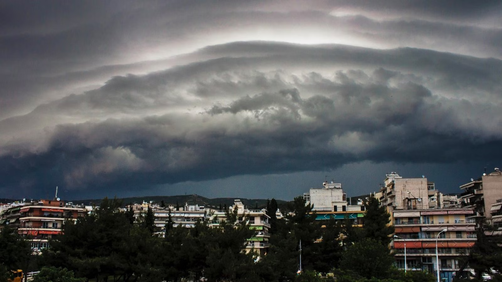
Recently, a massive Shelf Cloud formation has been spotted in Haridwar, Uttarakhand.
What are Shelf Clouds?
- About:
- Shelf clouds - also known as Arcus clouds - are often associated with powerful storm systems, and many times they are reported as wall clouds, funnel clouds, or rotation.
- These clouds are sometimes seen beneath cumulonimbus clouds, the dense, towering vertical cloud that causes intense rain.
- They often appear ahead of powerful Thunderstorms with heavy rain, strong winds, and occasionally hail or tornadoes.
- Formation:
- When a cold downdraft from a cumulonimbus cloud reaches the ground, the cold air may spread rapidly along the ground, pushing existing warm moist air upwards.
- As the cold air descends, it pushes warm air upward, causing condensation and cloud formation. This process creates the distinct horizontal shape and appearance of a shelf cloud.
What are the Types of Clouds?
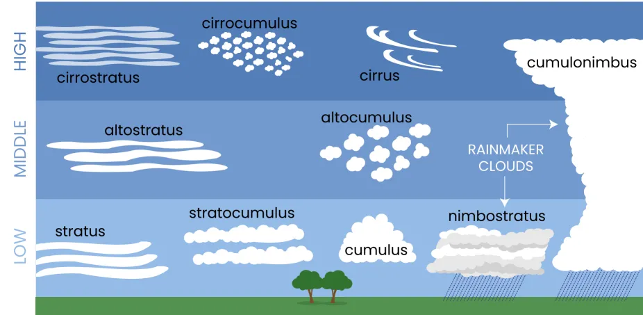
- High Clouds:
- Cirrus Clouds: Cirrus clouds are high-altitude clouds that appear wispy, feathery, and white. They are composed of ice crystals and are often associated with fair weather.
- Cirrus clouds can cause halo, a ring around the sun or the moon.
- Cirrocumulus Clouds: High-altitude clouds that appear as small, white, and fluffy cloud patches. They often have a wavy or honeycomb-like pattern.
- Cirrostratus Clouds: High-altitude clouds that form a thin, whitish veil covering the sky. They can produce halos around the sun or moon.
- Cirrus Clouds: Cirrus clouds are high-altitude clouds that appear wispy, feathery, and white. They are composed of ice crystals and are often associated with fair weather.
- Middle Clouds:
- Altocumulus Clouds: Mid-level clouds that form white or gray patches or layers. They often have a wavy or lumpy appearance.
- Altostratus Clouds: Mid-level clouds that create a uniform, gray or bluish-gray layer covering the sky. They are thicker and denser than cirrostratus clouds and can lead to light precipitation.
- Low Clouds:
- Cumulus Clouds: Cumulus clouds are fluffy, white clouds with a flat base and a rounded top. They are typically formed by rising warm air currents and are often seen on sunny days. Cumulus clouds can develop into cumulonimbus clouds, which are associated with thunderstorms.
- Stratus Clouds: Stratus clouds are low-level clouds that appear as a uniform grayish layer covering the sky. They often bring drizzle or light precipitation and can create a dull, overcast appearance.
- Stratocumulus Clouds: Low-level clouds with a patchy appearance, often appearing as rounded masses. They can be white or gray and cover a significant portion of the sky.
- Nimbostratus Clouds: Thick, dark, and featureless clouds that cover the sky. They bring continuous precipitation, often lasting for an extended period.
- Clouds that exhibit Significant Vertical Development:
- Cumulonimbus Clouds: Large, towering clouds associated with thunderstorms. They have a dark base and can reach high altitudes, producing heavy rain, lightning, and strong winds.
UPSC Civil Services, Previous Year Question (PYQ)
Q. Consider the following statements:
- High clouds primarily reflect solar radiation and cool the surface of the Earth.
- Low clouds have a high absorption of infrared radiation emanating from the Earth's surface and thus cause warming effect.
Which of the statements given above is/are correct?
(a) 1 only
(b) 2 only
(c) Both 1 and 2
(d) Neither 1 nor 2
Ans: (d)
Explanation:
- The study of clouds, where they occur, and their characteristics, play a key role in the understanding of climate change. Low, thick clouds primarily reflect solar radiation and cool the surface of the Earth. High, thin clouds primarily transmit incoming solar radiation; at the same time, they trap some of the outgoing infrared radiation emitted by the Earth and radiate it back downward, thereby warming the surface of the Earth. Hence, both statements are not correct.


