Important Facts For Prelims
INCOIS Study on Indian Ocean Floor Mapping
- 03 May 2024
- 5 min read
Why in News?
Recently, scientists at the Indian National Centre for Ocean Information Services (INCOIS) conducted a study on the mapping of the Indian Ocean floor to delve deeper into ocean currents and dynamics.
Note:
- ESSO-INCOIS was established as an autonomous body in 1999 under the Ministry of Earth Sciences (MoES) and is a unit of the Earth System Science Organisation (ESSO). It is located in Hyderabad.
- ESSO- INCOIS is mandated to provide the best possible ocean information and advisory services to society, industry, government agencies and the scientific community through sustained ocean observations and constant improvements through systematic and focused research.
What are the Key Highlights of the Study?
- Influence of Islands on Currents:
- The study reveals that the Andaman and Nicobar Islands, along with the Maldives, significantly influence the direction and speed of Indian Ocean currents, creating deep-swirling patterns opposite to surface currents.
- Improved Modelling with Accurate Bathymetry:
- Previous ocean modelling systems underestimated observed coastal currents around India.
- Incorporating accurate bathymetry data led to:
- Better predictions of upper ocean salinity, temperature, and currents near the coast.
- More realistic estimation of the East India Coastal Current (EICC) flow at deeper depths (1,000 and 2,000 metres), which flows opposite to the surface currents.
- The EICC is the western boundary current of the Bay of Bengal. It's a powerful current that reverses its direction twice a year, playing a crucial role in the ocean circulation of the region.
- The surface flow of the EICC from February to September, it flows northeastward along the Indian coast. From October to January, the flow reverses southward along both the Indian and Sri Lankan coasts.
- Identification of a boundary current along the Andaman and Nicobar Islands coast at a depth of 2,000 metres.
- Understanding the Maldives Islands' influence on the Equatorial Under Current (EUC).
- EUC is a permanent eastward-flowing current in the Atlantic and Pacific Oceans and is present in the Indian Ocean during the northeast monsoon in spring and winter.
- The presence of the Maldives Islands affects the westward extent of the EUC, with variations in depth and definition between seasons.
- Importance for Forecasting:
- Accurate oceanographic forecasting is essential for the maritime industry and has significant economic benefits.
- Accurate ocean forecasts vital for weather, climate, and maritime industry. Improved observations and models are key for precision predictions.
- Advancing Ocean Dynamics Understanding:
- The study highlights the importance of incorporating accurate bathymetry data into ocean circulation models. Aids in forecasting for Indian subcontinent and nearby regions.
What is Bathymetry?
- Bathymetry is the study and mapping of the underwater topography of water bodies, such as oceans, rivers, lakes, and streams.
- It involves measuring the depth of the water and is similar to mapping the topography of land.
- Bathymetric maps use contour lines to show the shape and elevation of underwater terrain.
- Bathymetry is the foundation of the science of hydrography, which measures the physical features of a water body.
- Hydrography includes not only bathymetry, but also the shape and features of the shoreline; the characteristics of tides, currents, and waves; and the physical and chemical properties of the water itself.
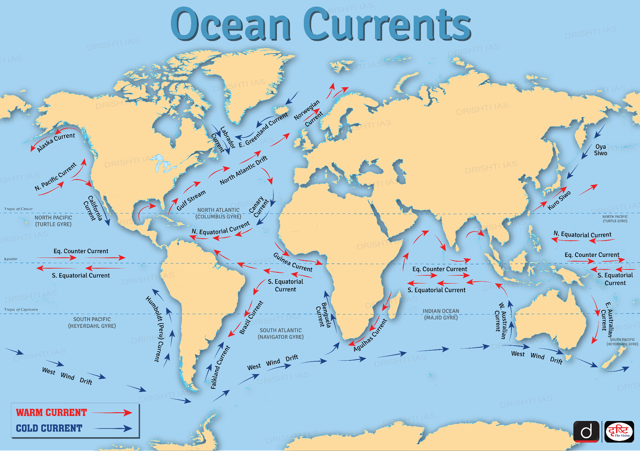
Read more: Ocean currents
UPSC Civil Services Examination, Previous Year Questions (PYQs)
Prelims
Q. The most important fishing grounds of the world are found in the regions where: (2013)
(a) warm and cold atmospheric currents meet
(b) rivers drain out large amounts of fresh water into the sea
(c) warm and cold oceanic currents meet
(d) continental shelf is undulating
Ans: (c)
Q. Consider the following factors:
- Rotation of the Earth
- Air pressure and wind
- Density of ocean water
- Revolution of the Earth
Which of the above factors influence the ocean currents? (2012)
(a) 1 and 2 only
(b) 1, 2 and 3
(c) 1 and 4
(d) 2, 3 and 4
Ans: (b)


