Climate Change and African Easterly Waves | 09 Jan 2025
Why in News?
A study published in Communications Earth & Environment predicts that climate change will increase the intensity and frequency of extreme flooding in the Sahel region, driven by changes in African easterly waves (AEWs).
What are the Key Highlights of the Study?
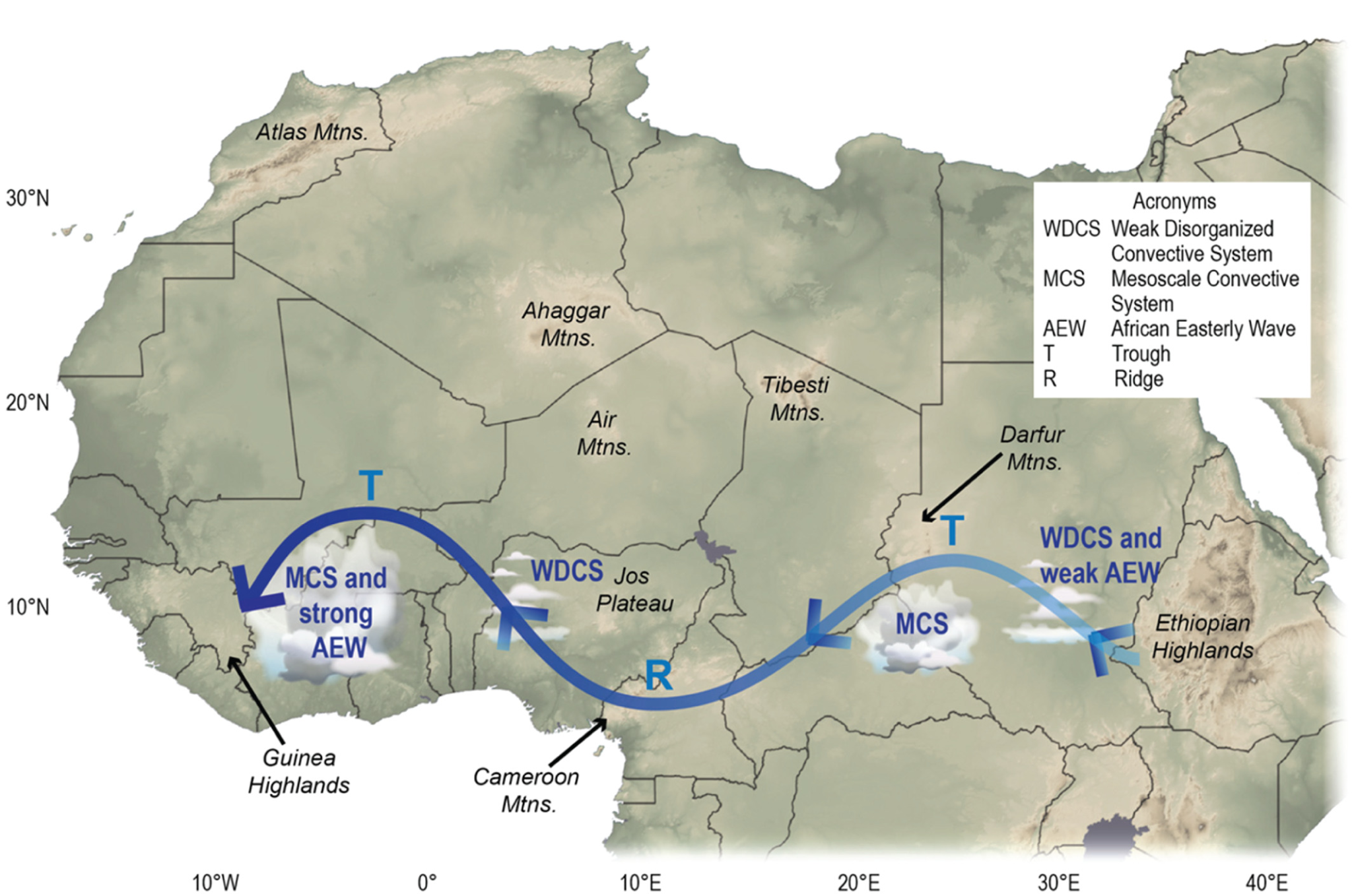
- Increased AEW Activity: The study predicts an increase in AEWs over the Sahel-Sahara by the end of 21st century.
- The intensification is driven by increased baroclinicity (variation in atmospheric pressure and density with height) due to a stronger meridional temperature gradient (difference in temperature between regions) between the Guinea Coast and the Sahara.
- Enhanced Monsoon Flow: The study found that low-level warming reinforces monsoon flow, increasing convergence (more air entering a vertical column than leaving it) and vertical motion of air along the intertropical discontinuity ( ITD ) altering AEWs formation.
- The ITD is the boundary between the hot and dry desert air and the cooler and more moist air from the Arabian Sea.
- Implications:
- Saharan Dust Transport: Strong winds from a northern track AEW (close to Sahara Desert) can transport dry Saharan air, preventing or delaying tropical cyclogenesis (the formation of tropical cyclones) until more favorable conditions in the warmer western Atlantic.
- Connection to MCSs: AEWs are linked to Mesoscale convective systems (MCSs), which cause extreme rainfall. The study suggests that increased AEW activity may lead to more frequent and intense flooding events in the Sahel.
What are African Easterly Waves?
- Definition: African easterly waves (AEWs) are weather systems that form over northern Africa during the summer and move east to west toward the Atlantic Ocean.
- Significance: AEWs bring rainstorms to drought-prone areas in northern Africa.
- Carry Saharan dust across the Atlantic ocean and AEWs act as precursors for Atlantic hurricanes.
- Influence: AEWs significantly affect the regional hydroclimate, particularly in the Sahel, making it essential to understand their behavior under global warming.
Sahel Region
- The Sahel is a semiarid region of western and north-central Africa, stretching from Senegal in the west to Sudan in the east.
- It acts as a transition between the Sahara Desert to the north and the humid savannas to the south.
- It features savanna terrain, with low-growing grass, thorny shrubs, and sparse vegetation.
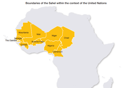
- The United Nations (UN) limits the Sahel to ten (10) countries they are Burkina Faso, Cameroon, The Gambia, Guinea, Mali, Mauritania, Niger, Nigeria, Senegal and Chad.
- The Niger River, the longest and largest in western Africa, is a major water source for the region.


