Geography
Floods Havoc in India
- 17 Jul 2023
- 14 min read
This editorial is based on Monsoon havoc in India which was published in The Indian Express on 17/07/2023. It talks about flood related issues in India
For Prelims: Central Water Commission, Monsoon, Cyclone Amphan, National Disaster Management Authority, Internal Displacement Monitoring Centre, Gangetic dolphin, Pradhan Mantri Fasal Bima Yojana
For Mains: Factors Affecting the Rainfall in India, Mitigation measures for Flood Disaster
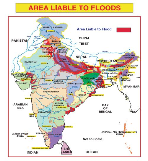
India is a country that faces the twin challenges of floods and droughts every year. The monsoon season, which brings about 75% of the annual rainfall, is also a time of great variability and uncertainty. Year after year, as the monsoon season progresses, floods wreak havoc, leaving behind a trail of destruction and despair. As the 2023 monsoon progresses, floods are beginning to repeat the pattern of damage and destruction. The magnitude of this issue becomes apparent when we consider the staggering statistics: an average of at least one major flood event each year, resulting in significant loss of life and extensive damage to land, crops, houses, and public utilities.
What are the Causes of Floods in India?
- Heavy Rainfall:
- This is the most common cause of floods in India. The monsoon season, which lasts from June to September, brings intense and erratic rainfall to different parts of the country.
- Sometimes, the rainfall exceeds the capacity of the soil to absorb or the drainage system to carry away the excess water, resulting in floods.
- For example, in July 2023, Delhi received ‘excess’ and ‘large excess’ rain on five out of eight days, from July 3-10. On July 9, it recorded 221.4 mm of rain, more than the 209.7 mm that is the average for all of July.
- This contributed to the flooding of large parts of the city.
- Snowmelt:
- The snow and glaciers in the mountains melt due to rising temperatures and flow down into the rivers and streams.
- This can increase the water level and cause floods downstream.
- For example, in February 2021, a massive flash flood occurred in Uttarakhand due to a glacial burst that triggered an avalanche of snow, ice, and debris.
- Cyclones and Storms:
- These are weather events that can bring strong winds and heavy rains along the coastal areas of India.
- They can cause storm surges, which are sudden rises in sea level due to low atmospheric pressure and high winds.
- Storm surges can inundate low-lying areas and cause coastal flooding.
- For example, in May 2020, Cyclone Amphan hit West Bengal and Odisha with wind speeds of up to 185 km/h and storm surges of up to 5 meters.
- River Overflow:
- This is a cause of floods that occurs when the water level in a river exceeds its carrying capacity due to excessive inflow from upstream or reduced outflow downstream.
- River overflow can be caused by factors such as heavy rainfall, snowmelt, cyclones, dams, barrages, or siltation.
- For example, in 2023, the Yamuna River overflowed its banks due to heavy rainfall in upstream states such as Himachal Pradesh and Haryana. The barrages in Delhi were unable to effectively regulate and redirect the river’s flow, leading to flooding of several areas along the river.
What are the Impacts of Floods in India?
- Loss of Life:
- Floods can cause fatalities due to drowning, injuries, infections, or electrocution. According to the National Disaster Management Authority(NDMA), floods are one of the most frequent and deadly natural disasters in India.
- Every year on average 1,600 lives is lost due to floods.
- Only half past 2023, at least 60 deaths have been confirmed due to floods across North India, though the actual toll may be higher.
- Damage to Property:
- Floods can damage or destroy houses, buildings, roads, bridges, railways, power lines, communication networks, and other infrastructure.
- Floods can also damage or wash away crops, livestock, vehicles, and other assets.
- According to the NDMA, floods affect about 75 lakh hectares of land and inflict damage worth Rs 1,805 crore to crops, houses and public utilities every year in India.
- In 2023, floods have caused extensive damage to several landmarks in Delhi, such as the Red Fort and the Supreme Court.
- Displacement of People:
- Floods can force people to leave their homes and seek shelter in safer places. This can disrupt their normal lives and livelihoods.
- Floods can also create humanitarian crises by affecting the availability of food, water, sanitation, health care, and education.
- According to the Internal Displacement Monitoring Centre, floods displaced about 5.4 million people in India in 2020.
- In 2023, floods have displaced thousands of people in North India, especially in Himachal Pradesh and Punjab.
- Environmental Degradation:
- Floods can have negative impacts on the environment by eroding the soil, altering the natural habitats of flora and fauna, polluting the water sources, and increasing the risk of landslides and epidemics.
- Floods can also affect the ecological balance of rivers and wetlands by changing their hydrology and biodiversity.
- For example, floods can threaten the survival of endangered species such as the Gangetic dolphin and the gharial in the Yamuna River.
- Economic Losses:
- Floods can affect the economic growth and development of India by reducing the agricultural output, disrupting the industrial production, affecting the trade and commerce, and increasing the expenditure on relief and rehabilitation.
- Floods can also affect the tourism sector by damaging the cultural heritage and natural attractions. According to a study by the World Bank, floods cost India about $14 billion annually in direct losses.
What are the Solutions for Flood Management in India?
- Structural Measures
- Storage Reservoirs:
- These are artificial structures that store water during high-flow periods and release it during low-flow periods.
- They can moderate the flood peak by reducing the volume and velocity of water downstream.
- They can also conserve water for irrigation, electricity generation, water supply, and other purposes.
- For example, the Bhakra Nangal Dam on the Sutlej River has a storage capacity of about 9.34 BCM (billion cubic meters) and helps in flood control as well as power generation and irrigation.
- Embankments:
- These are raised structures that confine the flow of water within a channel or along a bank.
- They can protect the adjacent areas from flooding by increasing the carrying capacity of the river or diverting the excess water to other channels.
- They can also provide access roads and recreational facilities along the river.
- For example, the Kosi embankment project in Bihar aims to prevent flooding by constructing embankments along both sides of the Kosi River.
- Diversions:
- These are structures that divert a part or all of the flow of water from one channel to another.
- They can reduce flooding by transferring excess water to less vulnerable areas or storage reservoirs.
- They can also provide irrigation or drinking water to other regions.
- For example, the Indira Gandhi Canal project diverts water from the Sutlej and Beas rivers to the Thar desert in Rajasthan for irrigation and drinking purposes.
- Storage Reservoirs:
- Non-structural Measures
- Flood Forecasting and Warning:
- This is a system that provides a prior estimate of approaching floods based on meteorological and hydrological data.
- It helps in timely evacuation of people and movable assets to safer places.
- It also helps in reservoir operation and flood relief coordination.
- For example, the Central Water Commission (CWC) operates a network of flood forecasting stations across India that issue daily bulletins and alerts on flood situations.
- Flood Plain Zoning:
- This is a regulatory measure that restricts or regulates the use of land in flood-prone areas based on their vulnerability and suitability.
- It aims to minimize the exposure and damage to human settlements and infrastructure by discouraging or prohibiting development activities in high-risk zones.
- It also promotes conservation and restoration of natural flood buffers such as wetlands and forests.
- For example, NDMA has issued guidelines for flood plain zoning in India that classify the land into four zones: prohibited, restricted, regulated, and free.
- Flood Insurance:
- This is a financial measure that provides compensation for losses caused by floods to individuals or groups who pay a premium to an insurance company.
- It aims to reduce the burden of relief and rehabilitation on the government and encourage risk reduction measures by the insured parties.
- It also helps in creating a database of flood risk and damage assessment. For example, the Pradhan Mantri Fasal Bima Yojana (PMFBY) is a crop insurance scheme that covers losses due to floods and other natural calamities.
- Flood Awareness and Education:
- This is a social measure that involves creating awareness and imparting knowledge about floods among various stakeholders such as communities, officials, media, NGOs, etc.
- It aims to enhance the preparedness and response capacity of people by providing information on flood hazards, risks, mitigation measures, early warning systems, evacuation routes, emergency contacts, etc.
- It also helps in building a culture of safety and resilience among people.
- For example, the NDMA conducts various awareness campaigns and training programs on flood management in India.
- Flood Forecasting and Warning:
What Should be the Way Forward?
- The entire suite of measures structural and non-structural, appropriate mix of grey, blue and green infrastructure needs to be considered for flood management.
- Mindsets need changing flood flows should be seen as a resource to be conserved for subsequent use and water security.
- A river basin approach should be adopted for flood management while taking care of the environment.
- It is prudent we upgrade the hydro-infrastructure in the country now so that the tools to manage increased variabilities are available in time.
|
Drishti Mains Question: Evaluate the role of structural and non-structural methods in flood management in India. What are the challenges and opportunities for water conservation in the context of climate change? |
UPSC Civil Services Examination Previous Year’s Question (PYQs)
Prelims:
Q. La Nina is suspected to have caused recent floods in Australia. How is La Nina different from El Nino? (2011)
- La Nina is characterised by an usually cold ocean temperature in the equatorial Indian Ocean whereas El Nino is characterised by unusually warm ocean temperature in the equatorial Pacific Ocean.
- El Nino has an adverse effect on the south-west monsoon of India but La Nina has no effect on the monsoon climate.
Which of the statements given above is/are correct?
(a) 1 only
(b) 2 only
(c) Both 1 and 2
(d) Neither 1 nor 2
Ans: (d)
Mains
Q. With reference to the National Disaster Management Authority (NDMA) guidelines, discuss the measures to be adopted to mitigate the impact of recent incidents of cloudbursts in many places of Uttarakhand. (2016)


